

General News
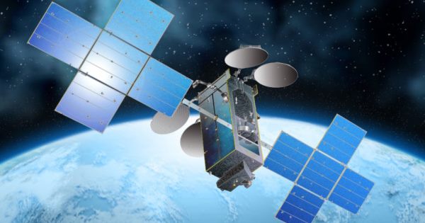
Satellite Technology is Ready When Needed for Border, Port & Maritime Security

By Andrew Aroh
We are still trying to figure out a lot of things in terms of threats, vulnerabilities and the integration of resources. We need to ensure that the satellite realm is recognized as critical infrastructure.

Satellite is a technology, which plays a critical role already, but most often omitted from formal discussions, and this is a huge problem.
Satellite communications is rarely mentioned as a specific solution or recommendation that spells out the need for improved communications and interoperability. There are instances, however, where attention is focused on a possible satellite solution such as border, port and maritime security. Recall the long-range vessel tracking system. In this case, we develop and implement a long-range automatic vessel tracking system for all vessels in Nigeria waters that are equipped with the Global Maritime Distress and Safety System or equivalent satellite technology. The system shall be designed to provide the safety agencies or the authority the capability of receiving information on vessel positions at interval positions appropriate to deter transportation security incidents.
The above underscores the pivotal role of satellite technology at sea, and offers a possible way to solve the vessel tracking puzzle, which is an important dimension of port and maritime security under a much broader concept known as maritime Domain Awareness [MDA] as well as the system known as the Universal Shipborne Automated Identification System [AIS].

SECURING CARGO AND PORTS:
- The goal here is to increase security throughout the entire international logistics chain by implementing security verification techniques. Building security into the global supply chain is a huge challenge.
- By expanding the role of satellite based systems such as GPS, AIS and the vessel Monitoring system, we can reinforce and extend our existing security verification techniques. Satellite technology is essential to making key elements of overall MDA system work.
- AIS a top priority which has been kicked into high gear by MDA. As a GPS-based system, AIS does include a possible long range interface with a satellite feed, for example.
The International Maritime Organization [IMO] is speeding up required carriage of AIS as well.
We have to have sufficient transparency and be able to verify low risk cargo as we go about building more confidence into our maritime and port security apparatus in general.
The process of tracking cargo as it moves along throughout complex intermodal transportation system mandates that we move our borders out, and provide security that moves with the box or container in question.
- Although satellite enjoys general recognition in terms of the key role it can play here, satellite is not going to happen without real advocacy. A good paper trial has to be wrapped around a regulatory model to drive more innovations in the maritime domain. This will enable the exploration of new technology such as electronic seals, vessel tracking and electronic notification of vessel arrivals.
- There is a growing interest in the use of satellites and GPS and global location systems to track the movement of cargo in real time. We are aware several companies have piloted advanced devices such as transponders and electronic seals, which when used with satellite technology, can pinpoint the location of a truck chassis, container, truck, ship or railcar in real time.
While the results of these demonstrations have been promising, we have also seen that this technology is feasible in a complex, commercial supply chain, on a practical as well as on an economic level.
Testing of satellite technology also upholds the devices for their ability to withstand the rigors of the commercial sea container/port environment, the effectiveness of the communication infrastructure, and their scalability, with the goal of developing requirements and protocols that can be commercialized within a competitive marketplace.
- While satellite technology is able to assist maritime security, primarily in terms of tracking ships or cargo consignments, resources could be a problem.
Again, it would be inordinately expensive to track everything, and would create a blockage nightmare as well.
However, if some sort of compromise over the level of blockage can be achieved, there is much promise in satellite technology.
- Remember, success will be very much reduced if some sort of tracking is not introduced for at least suspect vessels. So satellites would help very much, but again, depending upon the resources available. The Coast Guard [as the only resource] will certainly be stretched to do this vessel tracking job in a thorough manner.
BORDER PATROL LINKED VIA SATELLITE:
As for the nation’s borders, and the role of satellite technology in such programs as Smart Border Initiative, the National Transportation Security Plan and the National Land Border Security Plan, the door remains wide open. This is because for the large states, Cellular Digital Packet Data [CDPD] or Radio Frequency [RF] is not viable options.
- Therefore, we need the applications of satellite for data transfer. We can implement a limited number of satellite voice units to supplement regular radios in fringe coverage areas.
Absolutely, the recommendation is that the federal Government should spend more money to equip state law enforcement agencies in rural Border States with more satellite equipment [linked to NigComSat-1R] both for routine use as well as for enhanced border security purposes. Note that the border is one of the areas where we have the weakest coverage utilizing our existing radio technology. Hence any activity we participate with in those areas should see the benefit of satellite technology regardless of whether it is border security, search & Rescue or our other law enforcement missions.
- In every state, we can start with two vans assigned to perform commercial vehicle enforcement tasks equipped with two-way satellite terminals that can be used for dispatch as well as to instantaneously access driver and vehicle data anywhere in the state, including its remote border region. With the satellite technology, one can quickly check all the paperwork, validate the driver and verify that any Department of Transportation permits are valid, if required. One goal here is to simply increase monitoring presence in this remote and scarcely populated region both for safety and security purposes. The cost and ease of use of satellite gear are important considerations as well. There is no question that commercial vehicle enforcement activities represent a critical part of the overall plan to enhance border protection.
SATELLITE IMAGERY CONTROL:
- Besides making sure that satellite technology is used in the most effective way to protect borders, coasts, and port, government and military officials must also ensure that any group seeking to do harm does not gain access to high-resolution satellite imagery.
- We need policies for prohibiting the release of imagery beyond a certain resolution such as the guidelines provided by the appropriate security department, notification when an image crosses an international boundary, or when such a request is made by a person or group.
There is thus, a great need for effective and efficient schemes for facilitating such controlled dissemination of satellite imagery and the information products generated from it.
- Experts in the area of information systems security have access control model for high-resolution satellite image databases.
Commercial Satellite Organizations should proactively address sensitive satellite-related issues such as the fact that image collection or distribution must be constrained where there is an immediate and substantial threat to national security or foreign policy commitment.
FUTURE SOLUTIONS VIA SATELLITE:
Reliable and affordable satellite solutions are reliable and most can be quickly obtained as off the shell, commercial satellite products.
Enhancing border, port and maritime security may require the creation of novel hybrid solutions which can be useful to multiple agencies. Using the broad footprint of satellites, along with the proven reliability of satellite-based solutions can be brought to bear quickly on a variety of security-related objectives.
Andrew Aroh is President SSPI Nigeria


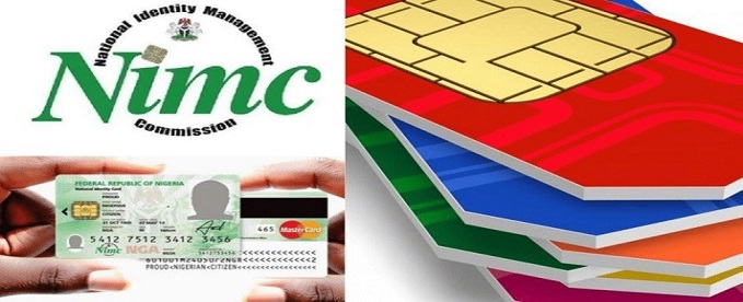
National Identity Management Commission (NIMC), has explained why kidnappers and terrorists are not always traceable despite the country’s expanding digital identity infrastructure.

NIMC explanation pointed to a simple but significant gap in the system.
Abisoye Coker-Odusote, director-general of the agency said that: “A lot of the time, you find out the kidnappers use the phones of the people they have abducted, which means how do you trace them because they are not using their own phones?” she said.
Coker-Odusote spoke during an appearance on Channels Television, where she was asked to explain why criminals remain difficult to trace despite the mandatory NIN-SIM linkage policy.
She said criminals frequently frustrate investigations by using mobile phones belonging to their victims, instead of their own registered lines.
“We already know the NIN is the foundational identity for the security architecture, but a lot of the time, you find out the kidnappers use the phones of the people they have abducted. Which means, how do you trace them because they are not using their own phones?” she said.
She also suggested that some criminal elements involved in kidnapping operations may not even be captured in Nigeria’s identity database.
“There is a theory that it may be possible that these kidnappers are not Nigerians and are brought into the country 48 or 72 hours before a kidnapping takes place specifically for that purpose. I’m not insinuating anything, but if that were the case, they naturally would not be captured in our database,” she added.
The comments have revived questions about whether expectations placed on the NIN-SIM linkage have exceeded what the system was designed to deliver.
The NIN-SIM linkage exercise was introduced by the Nigerian Communications Commission (NCC) in collaboration with NIMC to strengthen identity management, eliminate anonymous SIM ownership and support national security.
Over the years, the exercise resulted in millions of subscribers linking their SIM cards with their National Identification Numbers, while telecom operators also deactivated millions of lines that failed to comply with regulatory directives.
Earlier, the NCC maintained that the policy was aimed at improving the integrity of Nigeria’s SIM registration database, strengthening identity verification and supporting security agencies in criminal investigations.
The regulator also described the exercise as an important component of the country’s digital economy and national security framework.
Telecommunications operators have consistently maintained that while they play a critical role in implementing the NIN-SIM linkage policy, they are not responsible for tracking criminals.

Quest Merchant Bank recently hosted the second edition of the Great Place to Work® Nigeria Study Mission, reaffirming its commitment to fostering a high-performance workplace culture and advancing people-centric leadership practices.

The Study Mission serves as a collaborative learning platform that brings together Great Place to Work® Certified organizations to exchange insights, share best practices, and strengthen workplace cultures.
The event welcomed Human Resources leaders and representatives from FITC, Princeps Credit Systems, Tonic Technologies and Esentry Limited for an engaging and insightful session focused on building thriving workplace cultures, promoting continuous learning, and advancing employee-centric practices that drive organizational success.
Speaking at the event, Tolulope Dayo-Peters, Head of People Management, emphasized the importance of continuous learning and collaboration in building sustainable workplace cultures.
“We are delighted to host the second edition of the Great Place to Work® Nigeria Study Mission. At Quest Merchant Bank, we believe building a great workplace is an ongoing journey rooted in trust, purposeful leadership, and a genuine commitment to our people.
“We are pleased to share the practices that have shaped our culture and look forward to more opportunities to learn and collaborate with like-minded organizations.”
Also speaking at the event, Afolabi Olorode, Acting Managing Director/CEO, Quest Merchant Bank Limited, highlighted the critical role workplace culture plays in driving long-term business success.
“We recognize that a strong workplace culture is fundamental to sustainable business success. Creating an environment where our people are empowered to grow, innovate, and perform at their best enables us to consistently deliver value to our clients and stakeholders. We are proud to support initiatives like the Great Place to Work® Nigeria Study Mission that encourage organizations to learn from one another and collectively raise the standard of workplace excellence in Nigeria.”
The Study Mission reinforced the importance of collaboration among organizations committed to creating exceptional employee experiences.
By providing a platform for open dialogue, peer learning, and the exchange of practical ideas, the initiative enabled participants to explore innovative approaches to employee engagement, organizational culture, leadership development, and talent management while strengthening a growing community of employers dedicated to workplace excellence.
Hosting the Great Place to Work® Nigeria Study Mission further strengthens Quest Merchant Bank’s position as a thought leader in workplace culture and talent management.
It also enhances the Bank’s employer brand and demonstrates its unwavering commitment to creating an environment where employees can grow, innovate, and achieve their full potential.
Quest Merchant Bank remains committed to championing initiatives that promote learning, innovation, and people-centric leadership. Through strategic partnerships and knowledge-sharing platforms such as the Great Place to Work® Nigeria Study Mission, the Bank continues to contribute to the advancement of exceptional workplace cultures and the future of work across Nigeria’s corporate landscape.
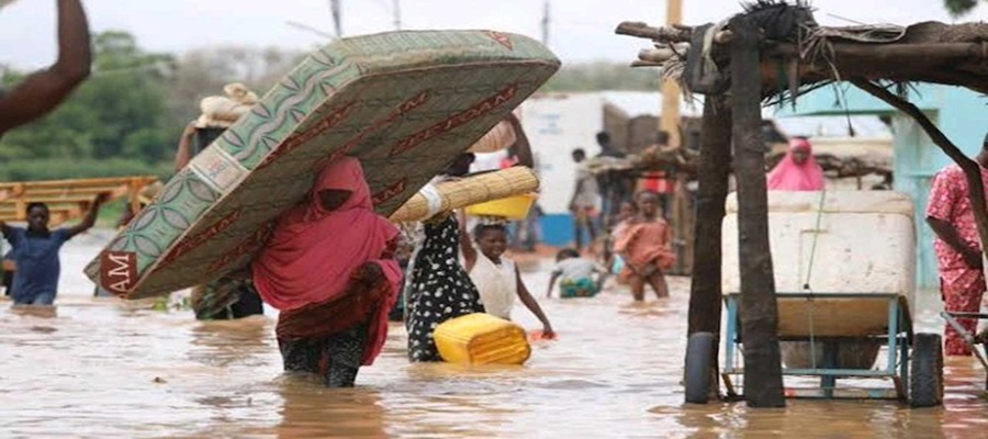
Nigeria Hydrological Service Agency (NIHSA) has warned of possible floods in parts of Adamawa, Bauchi, Edo, Imo, Enugu, Akwa Ibom, Cross River, Kaduna, Plateau, Niger, Benue, and Borno states within the next seven days.

According to information posted on NIHSA X handle, the Agency announced medium flood advisory in force for the next 7 days across Adamawa, Bauchi, and 11 other States.
“Localised inundation is forecast along the main channel; named communities below sit on the projected footprint. Stations: Saminara on the Karam river, Waya Dam Site on the Waya river, Amber on the Amber river.
“Adamawa; Lemsa, Lamurde, Numan Exposure: 147 comm. 49 schis 40 hith 6 mkts17 relig. Bauchi-Bauchi, Ningi, Shira. Exposure: 4 comm. Kaduna; Chikun, Giwa, Igabi, Jaba, Jema’a, Kachia, Kaura, Kauru, +6 more. Exposure: 1 comm.
“Borno-Gubio, Mobbar. Exposure: 680 comm. 8 schls 6 hith 5 mkts 21 relig. Edo-Akoko-Ed, EtsakoEa, EtsakoWe, Ikpoba-Okha, Orhionmw, OviaNort, OviaSo.. Exposure: 3 comm.
“Imo-Aboh-Mba, Oguta, Ohaji/Eg, Okigwe, Owerri North, Owerri West. Exposure: 3 comm. 7 more states affected and severity LGAs”.
NIHSA advised people in the affected areas to “do NOT cross flooded roads, bridges, or fast-moving water on foot or by vehicle.
“Clear drainage channels and river-mouth blockages; avoid building or living in the floodplain and move people, livestock and valuables from the floodplain to pre-identified higher ground,” NIHSA stated.

NBC Scraps Annual Digital Access Fee on DSO

Surge in Fibre Cuts Hobbles Service Provisioning

Why Bandits, Kidnappers are Hard to Trace despite NIN-SIM Linkage – FG

First Securities Brokers Empowers Nigerians to Trade in the Stock Market with the Launch of FirstInvest App

Quest Merchant Bank Hosts Great Place to Work® Nigeria Study Mission

NRC, Ponzi Scheme Collapses Resulting Loss of Billions of Naira
Nigeria Launches FreeTV Nationwide

NASENI Moves to Digitize CCB’s 5m Assets Declaration and Operations

Lebara Nigeria Launches Lebara Play, Africa’s First Telecom-Owned Micro-Drama Platform

CANAL+ Partners Samsung to Pre-Load DStv Stream on New Samsung TVs In Nigeria, Other African Countries


 Telecom2 days ago
MTN Nigeria Slashes Cost of Broadband Internet Router, Unwraps New Data Bundles for Low-Budget Users

 E-Financial2 days ago
Nigerians Accumulate $59Bn in Cryptocurrency Assets —FDC

 E-Financial2 days ago
Flutterwave Partners Xoom on Transfers into Nigeria

 General News2 days ago
Nearpays, Nigerian Fintech Becomes First African Startup to Win UN’s AI for Good Innovation Factory

 News2 days ago
DataPro Upgrades Dangote Cement’s Credit Rating to AA+

 Telecom2 days ago
Nokia’s 14 Years of Mobile-Phone Supremacy Ended in an Afternoon

 General News2 days ago
LASG Signs PPP Concession Agreements to Advance Digital Services, Others

 General News2 days ago
Fintech Brands Should Communicate Right in a VUCA Economy